AIN Fact Book Collection Part 1 (CJ)
+3
Thomas
Sky Guy
ForthWall
7 posters
Page 1 of 1

AIN Fact Book Collection Part 1 (CJ)
![]() by ForthWall 27th August 2010, 23:50
by ForthWall 27th August 2010, 23:50
I will be braking this into parts because this will require a lot of information
Part 1 includes two requirements for the AIN Nations section
I will provide an example later -- (I will post below)
1. Nation name:
2. is just a basic summery of your nation (minimum 1 picture -- maximum 6 pictures)
3. Give a history Brief/long any one you want (maximum 1 picture)
Part 1 includes two requirements for the AIN Nations section
I will provide an example later -- (I will post below)
1. Nation name:
2. is just a basic summery of your nation (minimum 1 picture -- maximum 6 pictures)
3. Give a history Brief/long any one you want (maximum 1 picture)
Last edited by ForthWall on 23rd December 2010, 16:50; edited 1 time in total

ForthWall- Chancellor
- Posts : 2007
Age : 27
Re: AIN Fact Book Collection Part 1 (CJ)
![]() by Sky Guy 28th August 2010, 16:11
by Sky Guy 28th August 2010, 16:11
1. Nation name: Sultanate of Bangorai'
2. is just a basic summery of your nation (minimum 1 picture -- maximum 6 pictures)
Bangorai', officially the Sultanate of Bangorai' (pronounced /ˈbæŋɔɹaɪ/), is a small nation in Southeast Asia. It occupies the northwest tip of the island of Borneo. Bangorai' is comprised of the mainland area, as well as several islands off the coast in the South China Sea. Bangorai' has a growing population of over 18 million people. The country shares borders with Malaysia to the east, Indonesia to the south, and the South China Sea to the north and west. Being near the equator gives the country a tropical climate.
The government is a Sultanate that was started when the country first gained it's independence, but despite having a single ruler, the nation still has may freedoms and rights. The current leader is Buana Klahan Jebat.
Today, Bangorai' is a major commercial, banking, and shipping center of Southeast Asia. Despite a growing economy and widespread oil wealth, poverty is widespread, especially in the major urban centers like Banku Taou', Mae Rayong, and Pamang Buri.


3. Give a history Brief/long any one you want (maximum 1 picture)
Kapunian Civilization
Bangorai's history dates back to the 12 century (approximately 1178 A.D.) During this time, the colonization along the Kapuas River occurred. There are several temple sites in the Delta area and only recently has archaeological work been done on them. Theses early peoples, recently named the Kapunians, cultivated the land and built several interconnected cities. The population of the Kapunian Empire at it's height was only a few thousand, but archeologists have found that they had a vast trading system with other empires at the time.
British control and Independence
In the late 1700s, only recently after the massive migration to Malaysia, flocks of Europeans, mainly British, came to Bangorai' and claimed control over the area. They brought Christianity to the nation, and soon the population was rapidly increasing. The British established a capital city on the banks of the Kapuas River and began trading tea, rice, and other exotic items, as part of the East India Trading Company, to the western world. Even today, the impact of these colonialists can be seen in the architecture and way of life. Shortly after World War II, thoughts of Independence were growing. Many Guerilla fighters came into act, trying to push the British out. Their attempts were unsuccessful, however, at the same time, similar events were occurring on the Malay Peninsula, and as a way to get out of fighting two fronts, the British gave in. Finally on March 14, 1951, a peaceful treaty was arranged, and the new Sultanate of Bangor was created.
Communist Revolt
The small, poor nation was now on it's own. Finally after several unprosperous years, oil was discovered in large quantities. The country was finally entering the world market. However, before it could stablize, communism erupted in the nation. Once again Bangorai' was edging towards war- this time with itself. The leader of the communist group, Jeharo Ali Watima, crashed into the capital city and in a series of terrorist acts, the Sultan was killed. Jeharo set alight the oil fields and set up a small military group to patrol the capital city, keeping the citizens under control and in fear. Finally the U.S. army and other alliance nations came into act to prevent the further spread of communism. The battle was brief, and surprisingly the communists were defeated. The old government was helped put into place, this time with many democratic additions. The fires were put out and the oil began to be pumped once more. As a protection act and for further expansion, the United States established a naval base in the small city of Kaeo Wat and the city became an American Dependancy.
Modern Bangorai'
Through the 80's and 90's, Bangorai' began to expand. In 1989, the capital was moved from Ben Pelaou, the old colonial city of the south, to the new largest city in the country- Banku Taou'. This fairly recent metropolis provided many new business opportunities and the hopes of a beautiful capital. With this step, Bangorai' became known to the world. In the development boom of the 90's, many of Bangorai's tallest buildings were built. Many developers became bankrupt, and today you can see some of the abandoned construction sites such as Kajara. Banku Taou' didn't receive much growth due to the city's proximity to the old airport, but when the new International Airport was opened in 2000, skyscrapers began to be seen on each street corner, and today there is no slowing down. Today, Bangorai's economy is flourishing and the nation is fast becoming a hotspot for tourism, industry, and commerce. The main population centers are the capital (Banku Taou'), the Tri Cities/ Mae Rayong, and the Kapuas River Delta.
2. is just a basic summery of your nation (minimum 1 picture -- maximum 6 pictures)
Bangorai', officially the Sultanate of Bangorai' (pronounced /ˈbæŋɔɹaɪ/), is a small nation in Southeast Asia. It occupies the northwest tip of the island of Borneo. Bangorai' is comprised of the mainland area, as well as several islands off the coast in the South China Sea. Bangorai' has a growing population of over 18 million people. The country shares borders with Malaysia to the east, Indonesia to the south, and the South China Sea to the north and west. Being near the equator gives the country a tropical climate.
The government is a Sultanate that was started when the country first gained it's independence, but despite having a single ruler, the nation still has may freedoms and rights. The current leader is Buana Klahan Jebat.
Today, Bangorai' is a major commercial, banking, and shipping center of Southeast Asia. Despite a growing economy and widespread oil wealth, poverty is widespread, especially in the major urban centers like Banku Taou', Mae Rayong, and Pamang Buri.
3. Give a history Brief/long any one you want (maximum 1 picture)
Kapunian Civilization
Bangorai's history dates back to the 12 century (approximately 1178 A.D.) During this time, the colonization along the Kapuas River occurred. There are several temple sites in the Delta area and only recently has archaeological work been done on them. Theses early peoples, recently named the Kapunians, cultivated the land and built several interconnected cities. The population of the Kapunian Empire at it's height was only a few thousand, but archeologists have found that they had a vast trading system with other empires at the time.
British control and Independence
In the late 1700s, only recently after the massive migration to Malaysia, flocks of Europeans, mainly British, came to Bangorai' and claimed control over the area. They brought Christianity to the nation, and soon the population was rapidly increasing. The British established a capital city on the banks of the Kapuas River and began trading tea, rice, and other exotic items, as part of the East India Trading Company, to the western world. Even today, the impact of these colonialists can be seen in the architecture and way of life. Shortly after World War II, thoughts of Independence were growing. Many Guerilla fighters came into act, trying to push the British out. Their attempts were unsuccessful, however, at the same time, similar events were occurring on the Malay Peninsula, and as a way to get out of fighting two fronts, the British gave in. Finally on March 14, 1951, a peaceful treaty was arranged, and the new Sultanate of Bangor was created.
Communist Revolt
The small, poor nation was now on it's own. Finally after several unprosperous years, oil was discovered in large quantities. The country was finally entering the world market. However, before it could stablize, communism erupted in the nation. Once again Bangorai' was edging towards war- this time with itself. The leader of the communist group, Jeharo Ali Watima, crashed into the capital city and in a series of terrorist acts, the Sultan was killed. Jeharo set alight the oil fields and set up a small military group to patrol the capital city, keeping the citizens under control and in fear. Finally the U.S. army and other alliance nations came into act to prevent the further spread of communism. The battle was brief, and surprisingly the communists were defeated. The old government was helped put into place, this time with many democratic additions. The fires were put out and the oil began to be pumped once more. As a protection act and for further expansion, the United States established a naval base in the small city of Kaeo Wat and the city became an American Dependancy.
Modern Bangorai'
Through the 80's and 90's, Bangorai' began to expand. In 1989, the capital was moved from Ben Pelaou, the old colonial city of the south, to the new largest city in the country- Banku Taou'. This fairly recent metropolis provided many new business opportunities and the hopes of a beautiful capital. With this step, Bangorai' became known to the world. In the development boom of the 90's, many of Bangorai's tallest buildings were built. Many developers became bankrupt, and today you can see some of the abandoned construction sites such as Kajara. Banku Taou' didn't receive much growth due to the city's proximity to the old airport, but when the new International Airport was opened in 2000, skyscrapers began to be seen on each street corner, and today there is no slowing down. Today, Bangorai's economy is flourishing and the nation is fast becoming a hotspot for tourism, industry, and commerce. The main population centers are the capital (Banku Taou'), the Tri Cities/ Mae Rayong, and the Kapuas River Delta.
Last edited by Sky Guy on 28th August 2010, 22:15; edited 1 time in total

Sky Guy- Chargé d'Affaires
- Posts : 1185
Age : 31
Re: AIN Fact Book Collection Part 1 (CJ)
![]() by Thomas 28th August 2010, 21:42
by Thomas 28th August 2010, 21:42
Nation name
Royal and Holy Kingdom of Cattala
Basic summary of your nation

Cattala is a Mediterranean country located just south of Italy and Sicily, and is home to two million people. The capital city is Celeste, and has been the home of the Royal Family of Cattala for centuries. The city is centred around the Alder Hill district, along the southern coast where the Government is based. Many aristocratic and wealthy families have lived in the city, and sprawling mansions are uncommon in the underdeveloped areas. To the east is the biggest and most populated city of Jennai, which has been the industrial and economic powerhouse of the country since the days of imperialism. More than a million people live in the city and its commuter towns, whilst the country's biggest corporations and dozens of regional headquarters for multinationals are located within the central business district.
The second biggest city is Calora, a mainly suburban city located just north of Celeste. It is linked to Jennai by a motorway and a busy railway, and is home to over 300,000 people. Calora was once a thriving port town, until the two world wars and a decline in international trade led to its closure and the city centre moved much further inland, near to the main railway terminal.

3. Give a history Brief/long any one you want
In the first decade of the 19th century, peace in Cattala remained despite ongoing wars across Europe, mainly fuelled by Napoleon Bonaparte. The House of Celestine, having ruled for nearly 800 years now, had named and created the capital city after their surname and had built a high-class Mediterranean city home to around 50,000 aristocratic families and foreign diplomats. Much of the population lived and worked in farming communities spread across the country.
But the 1814 Treaty of Paris gave the British Empire control over the nearby island of Malta, leading the vast Royal Navy to threaten the shores of the Kingdom. Warships surrounded the south and east of the country, and King Harold was forced to abdicate the throne and Cattala was declared a British Colony, with the current Royal Guard (Head of the Government) being replaced by a Governor.
For the next half century, over 200,000 British citizens emigrated to Cattala from across the Commonwealth, and the population rose to 750,000. English became the main language of the colony, and British culture spread rapidly around the islands. The port in Calora became a hub for aristocracy arriving from the UK and Canada, and the town sprawled into a vast city and moved further into the countryside. Ontano Island’s agricultural industry boomed local delicacies became popular with the wealthy immigrants, and the island was renamed as two villages were created – Aldoak and Brunswick.
However the age of imperial expansion in Cattala shuddered to a halt in 1860 when Italian nationalists, buoyant after seizing control of the Kingdom of the Two Sicilies earlier in the year, invaded from Ontano Island and Calora Harbour, destroying all of the villages and towns in the southern islands, including Brunswick and Aldoak. Calora Harbour was captured and shut down by the Italian Navy, as the British forces rested in Malta, unaware of the ongoing situation. Within a week strategic locations across Cattala were under Italian control and a treaty was signed with the furious British Crown to hand over the dominion to the Kingdom of Italy and the Governor was hanged.
But the son of King Harold, Prince Amadeus, attempted to gather a military to fight off the Italian invaders and protect the chance of his family returning to power. But Amadeus was nearly 50 when the Italians invaded, and his small militia was vastly outnumbered. Public support in Celestine and Calora was high, and the King of Italy was concerned of a possible backlash if the deposed royal family was defeated by force. So a peace treaty was signed, and a small province was given to Amadeus along the Celestine town border, ultimately controlled by the Italians though.
The end of British rule was abrupt and shocking for those that moved to Cattala from the rest of the Commonwealth. A vast majority of the trade from the islands was with the Empire, and over 50% of the population became unemployed within the first decade of unification with the mainland. Agriculture was severely damaged by droughts throughout the early 20th century, which crippled the economy and poverty spread rapidly across Cattala and Celestine. Calora Harbour closed down, Jennai became a slum city for hundreds of thousands of unemployed poor and the only successful area was the military base and capital city, the rebuilt Porto D’Italia, now located in the south to fend off any invasion from Malta.
Prior to the Great War, Cattala continued to be under strict Italian rule, which continued to cripple the economy and faith in the Government continued freefalling. In 1912, many Cattalians left the country to move to the newly-captured island of Rhodes, now a strong ally of the country.
During World War One however, all young men were drafted into the Entente, which led to vast casualties for the Cattala Regiment. The losses were atrocious, with over 100,000 men killed, missing or left behind. The outrage that had been boiling up for generations bubbled over, and riots were reported across the country. The President of Cattala, who simply reported back to Rome and not the people, was captured and burnt to death, over 50 police officers and troops were shot dead during the winter of 1917/18 and the Union Flag, a symbol to the impoverished Cattalians of a brighter past, was hoisted above the former Royal Palace in Celeste, and Prince Amadeus’ son took the throne as King Charles III.
The beginning of World War Two unnerved many Cattalians, with tens of thousands more fleeing the country. For the first year very little happened to the country, and many thought that the war wouldn’t reach them. However in 1940 hundreds of Italian bombers attacked Celestine and destroyed the military base to the north of the city, wiped out the southern harbour and severely damaged over 4000 homes, shops and Government offices, including the Parliament. German U-Boats and Italian naval submarines surrounded Jennai City and threatened to flatten the biggest population centre in the country unless King Charles surrendered.
The King evacuated his family to a small harbour in Porto D’Italia where they were secretly picked up by a small British plane, and taken to a North African military base before heading to exile in London. Charles the Third was flown to Rome aboard Royal Cattala Airways flight SFTPOC1, a special war coding that hid the message “Sacrifice For The People Of Cattala One”, where he was reportedly hung. For the next three years Cattala was under the control of the Italians, who turned much of the countryside into air bases and training camps for Nazi and Fascist troops. An influx of German and Italian military personnel concerned the general population, especially in cities like Calora and Jennai which were expected to be prime targets for Allied bombing raids.
As the war continued, British and American forces battled the axis frontline in Africa, and in 1943 the Italian troops were pushed back into Cattala where hostile and impoverished islanders assisted the allied soldiers with medicine, food, shelter and ammunition as both the Amadeus Resistance Army (named after the anti-Italian prince) and the British 8th Army battled with the fascists for months until the withdrawal when the British/Canadian/American coalition moved into Sicily on July the 10th 1943.
(from the Cattala History thread)

Royal and Holy Kingdom of Cattala
Basic summary of your nation
Cattala is a Mediterranean country located just south of Italy and Sicily, and is home to two million people. The capital city is Celeste, and has been the home of the Royal Family of Cattala for centuries. The city is centred around the Alder Hill district, along the southern coast where the Government is based. Many aristocratic and wealthy families have lived in the city, and sprawling mansions are uncommon in the underdeveloped areas. To the east is the biggest and most populated city of Jennai, which has been the industrial and economic powerhouse of the country since the days of imperialism. More than a million people live in the city and its commuter towns, whilst the country's biggest corporations and dozens of regional headquarters for multinationals are located within the central business district.
The second biggest city is Calora, a mainly suburban city located just north of Celeste. It is linked to Jennai by a motorway and a busy railway, and is home to over 300,000 people. Calora was once a thriving port town, until the two world wars and a decline in international trade led to its closure and the city centre moved much further inland, near to the main railway terminal.
3. Give a history Brief/long any one you want
In the first decade of the 19th century, peace in Cattala remained despite ongoing wars across Europe, mainly fuelled by Napoleon Bonaparte. The House of Celestine, having ruled for nearly 800 years now, had named and created the capital city after their surname and had built a high-class Mediterranean city home to around 50,000 aristocratic families and foreign diplomats. Much of the population lived and worked in farming communities spread across the country.
But the 1814 Treaty of Paris gave the British Empire control over the nearby island of Malta, leading the vast Royal Navy to threaten the shores of the Kingdom. Warships surrounded the south and east of the country, and King Harold was forced to abdicate the throne and Cattala was declared a British Colony, with the current Royal Guard (Head of the Government) being replaced by a Governor.
For the next half century, over 200,000 British citizens emigrated to Cattala from across the Commonwealth, and the population rose to 750,000. English became the main language of the colony, and British culture spread rapidly around the islands. The port in Calora became a hub for aristocracy arriving from the UK and Canada, and the town sprawled into a vast city and moved further into the countryside. Ontano Island’s agricultural industry boomed local delicacies became popular with the wealthy immigrants, and the island was renamed as two villages were created – Aldoak and Brunswick.
However the age of imperial expansion in Cattala shuddered to a halt in 1860 when Italian nationalists, buoyant after seizing control of the Kingdom of the Two Sicilies earlier in the year, invaded from Ontano Island and Calora Harbour, destroying all of the villages and towns in the southern islands, including Brunswick and Aldoak. Calora Harbour was captured and shut down by the Italian Navy, as the British forces rested in Malta, unaware of the ongoing situation. Within a week strategic locations across Cattala were under Italian control and a treaty was signed with the furious British Crown to hand over the dominion to the Kingdom of Italy and the Governor was hanged.
But the son of King Harold, Prince Amadeus, attempted to gather a military to fight off the Italian invaders and protect the chance of his family returning to power. But Amadeus was nearly 50 when the Italians invaded, and his small militia was vastly outnumbered. Public support in Celestine and Calora was high, and the King of Italy was concerned of a possible backlash if the deposed royal family was defeated by force. So a peace treaty was signed, and a small province was given to Amadeus along the Celestine town border, ultimately controlled by the Italians though.
The end of British rule was abrupt and shocking for those that moved to Cattala from the rest of the Commonwealth. A vast majority of the trade from the islands was with the Empire, and over 50% of the population became unemployed within the first decade of unification with the mainland. Agriculture was severely damaged by droughts throughout the early 20th century, which crippled the economy and poverty spread rapidly across Cattala and Celestine. Calora Harbour closed down, Jennai became a slum city for hundreds of thousands of unemployed poor and the only successful area was the military base and capital city, the rebuilt Porto D’Italia, now located in the south to fend off any invasion from Malta.
Prior to the Great War, Cattala continued to be under strict Italian rule, which continued to cripple the economy and faith in the Government continued freefalling. In 1912, many Cattalians left the country to move to the newly-captured island of Rhodes, now a strong ally of the country.
During World War One however, all young men were drafted into the Entente, which led to vast casualties for the Cattala Regiment. The losses were atrocious, with over 100,000 men killed, missing or left behind. The outrage that had been boiling up for generations bubbled over, and riots were reported across the country. The President of Cattala, who simply reported back to Rome and not the people, was captured and burnt to death, over 50 police officers and troops were shot dead during the winter of 1917/18 and the Union Flag, a symbol to the impoverished Cattalians of a brighter past, was hoisted above the former Royal Palace in Celeste, and Prince Amadeus’ son took the throne as King Charles III.
The beginning of World War Two unnerved many Cattalians, with tens of thousands more fleeing the country. For the first year very little happened to the country, and many thought that the war wouldn’t reach them. However in 1940 hundreds of Italian bombers attacked Celestine and destroyed the military base to the north of the city, wiped out the southern harbour and severely damaged over 4000 homes, shops and Government offices, including the Parliament. German U-Boats and Italian naval submarines surrounded Jennai City and threatened to flatten the biggest population centre in the country unless King Charles surrendered.
The King evacuated his family to a small harbour in Porto D’Italia where they were secretly picked up by a small British plane, and taken to a North African military base before heading to exile in London. Charles the Third was flown to Rome aboard Royal Cattala Airways flight SFTPOC1, a special war coding that hid the message “Sacrifice For The People Of Cattala One”, where he was reportedly hung. For the next three years Cattala was under the control of the Italians, who turned much of the countryside into air bases and training camps for Nazi and Fascist troops. An influx of German and Italian military personnel concerned the general population, especially in cities like Calora and Jennai which were expected to be prime targets for Allied bombing raids.
As the war continued, British and American forces battled the axis frontline in Africa, and in 1943 the Italian troops were pushed back into Cattala where hostile and impoverished islanders assisted the allied soldiers with medicine, food, shelter and ammunition as both the Amadeus Resistance Army (named after the anti-Italian prince) and the British 8th Army battled with the fascists for months until the withdrawal when the British/Canadian/American coalition moved into Sicily on July the 10th 1943.
(from the Cattala History thread)
Last edited by Thomas on 20th November 2010, 20:27; edited 1 time in total

Thomas- Overlord of Eurasia
- Posts : 5849
Re: AIN Fact Book Collection Part 1 (CJ)
![]() by Liberater444 1st September 2010, 05:30
by Liberater444 1st September 2010, 05:30
Nation name: Tirnreich
Basic summary of your nation
The Tirnreich is a small nation in Central Europe. It gained its independence in October of 2009, and has been working to build up its own infrastructure and support, and so far it's been a fairly easy journey. However, there's some big plans coming up; The Tirnreich is set to bid for the May Simlympics, a very important and competitive race to host the largest SimSporting event in the world. The Tirnreich has also started planning the construction of the TirnIsle, and has recently gained the land known as Jumaane.

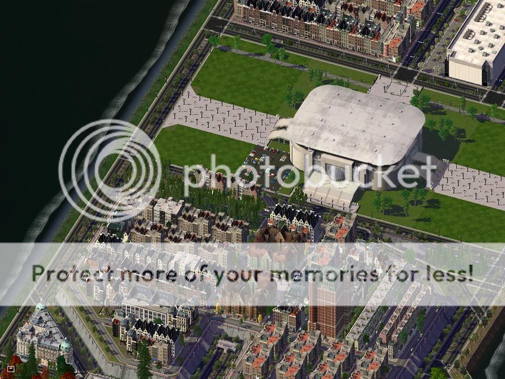
Baushann Platz. The building is the only all-residential building in the French Wall district. It was built in 1988, when an influx of French immigrants, thanks to East German relaxation of immigration laws, came to the city to help build the port and railroads that the city is known for today.

Traffic on the Jentz-Rourk Causeway. The Causeway connects Southwest Nachtsburg with West Nachtsburg. Basically, this connects the mostly Residential district of SW Nachtsburg with the commercial and corporate West Nachtsburg.
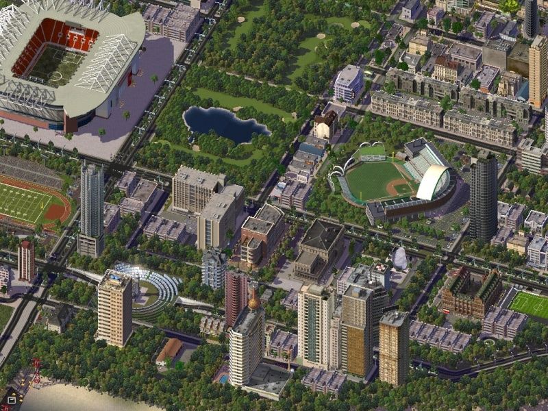
This photo shows the Civic Center of Republik Stadt, where you can see the police station, hospital, Ministry of Education building, and Republikschule.

Ardenburg Circle Terminal-Private. Private parking for Ardenburg Circle Terminal, a private terminal for use by corporate teams, delegates, and wealthy persons. Not for recreational use.
History Brief
The Tirnland in the 1800's was mainly undeveloped farmland, with vast forests, several castles, numerous spread out villages, and a foundation as a Kingdom. Before then, the land was mainly contested over by Prince Samzaln von Prussia and Ludwig Gessenkar, of Hekli. Ludwig eventually gained control, and was crowned King Ludwig von Hekli, Emperor of the Tirnland.
Since 1892, the Tirnreich was part of the German Empire, and was annexed as a territory. The Tirnland had a vital role in WWI, which was stopping the Russians from reaching the German homeland. The land was churned up for making room for trenches and other defensive features.
In WWII, the Tirnland was again nearly totally leveled in hopes of repelling a Russian counterattack after the winter of 1940. Trenches, field hospitals and offices, barracks, staging grounds; the Tirnland hosted all. After the war was over, the Soviet Union gained control of the Tirnland via Czechoslovakia, Poland, and East Germany.
Over the years of the Cold War, civil projects in the 'land were stagnating, there was little rebuilding efforts made, and architecture started to show Soviet influences.
After the Cold War, the German Third gained much more money for restarting civic projects, while the Polish and Czech Thirds struggled to make money. They broke away in the early 2000's, leaving only the German Third still under control of Germany. In 2009, after petitions and declarations signed, the Tirnland and Germany had a brief conflict, where German forces tried to reclaim Nachtsburg. On 3. October 2009, the Tirnland was reunified after over a hundred years, renamed "Tirnreich," and had Prince Konrad von Nacht crowned as Sovereign Emperor of the Tirnreich Empire.
Basic summary of your nation
The Tirnreich is a small nation in Central Europe. It gained its independence in October of 2009, and has been working to build up its own infrastructure and support, and so far it's been a fairly easy journey. However, there's some big plans coming up; The Tirnreich is set to bid for the May Simlympics, a very important and competitive race to host the largest SimSporting event in the world. The Tirnreich has also started planning the construction of the TirnIsle, and has recently gained the land known as Jumaane.
Baushann Platz. The building is the only all-residential building in the French Wall district. It was built in 1988, when an influx of French immigrants, thanks to East German relaxation of immigration laws, came to the city to help build the port and railroads that the city is known for today.
Traffic on the Jentz-Rourk Causeway. The Causeway connects Southwest Nachtsburg with West Nachtsburg. Basically, this connects the mostly Residential district of SW Nachtsburg with the commercial and corporate West Nachtsburg.
This photo shows the Civic Center of Republik Stadt, where you can see the police station, hospital, Ministry of Education building, and Republikschule.
Ardenburg Circle Terminal-Private. Private parking for Ardenburg Circle Terminal, a private terminal for use by corporate teams, delegates, and wealthy persons. Not for recreational use.
History Brief
The Tirnland in the 1800's was mainly undeveloped farmland, with vast forests, several castles, numerous spread out villages, and a foundation as a Kingdom. Before then, the land was mainly contested over by Prince Samzaln von Prussia and Ludwig Gessenkar, of Hekli. Ludwig eventually gained control, and was crowned King Ludwig von Hekli, Emperor of the Tirnland.
Since 1892, the Tirnreich was part of the German Empire, and was annexed as a territory. The Tirnland had a vital role in WWI, which was stopping the Russians from reaching the German homeland. The land was churned up for making room for trenches and other defensive features.
In WWII, the Tirnland was again nearly totally leveled in hopes of repelling a Russian counterattack after the winter of 1940. Trenches, field hospitals and offices, barracks, staging grounds; the Tirnland hosted all. After the war was over, the Soviet Union gained control of the Tirnland via Czechoslovakia, Poland, and East Germany.
Over the years of the Cold War, civil projects in the 'land were stagnating, there was little rebuilding efforts made, and architecture started to show Soviet influences.
After the Cold War, the German Third gained much more money for restarting civic projects, while the Polish and Czech Thirds struggled to make money. They broke away in the early 2000's, leaving only the German Third still under control of Germany. In 2009, after petitions and declarations signed, the Tirnland and Germany had a brief conflict, where German forces tried to reclaim Nachtsburg. On 3. October 2009, the Tirnland was reunified after over a hundred years, renamed "Tirnreich," and had Prince Konrad von Nacht crowned as Sovereign Emperor of the Tirnreich Empire.

Liberater444- Ambassador At Large
- Posts : 1432
Re: AIN Fact Book Collection Part 1 (CJ)
![]() by Forsma 3rd September 2010, 16:00
by Forsma 3rd September 2010, 16:00
1. Nation name: Federal Constitutional Republic of Starfishland
2. is just a basic summery of your nation (minimum 1 picture -- maximum 6 pictures)
Flag:

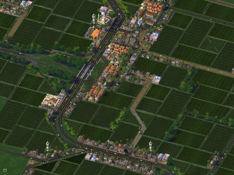
Starfishland is a Federal Republic nation located in the North Center Pacific. Capital is Starfishcity with population over 4.3 m located in the south of the nation. Since 2001 Headed by President Chip Kane jr and since 2005 have PM Mort Sanford. Starfishland has 6 dependencies those are: African Bristol, Glen Islands, Mosavia, Norfolk, Starfish Islands, and West Rockcoast.

^East Broker Stadium, a home of Starfishcity FC

^A view from Kane int Airport.

^Downtown Starfishcity.

^South Broker Port.
3. Give a history Brief/long any one you want (maximum 1 picture)
Starfishland was firstly found by Sir Francis Holmes, a British explorer in 1618 as a large plot of land. The name of Starfishland was taken when Holmes found a rare type of starfish in the east of the land. After the found of Starfishland, the British Kingdom made Starfishland as a colony from 1619 until 1768. In 1768, Kingdom of Starfishland was officially founded with King George I as a king.
King George II (1784-1845) in 1786 made a trip to the west of the kingdom in order to expand its territory. In 1788, King sent a explorer named John Bradley to found another land in South Asia to made them into a large scale spice producer. Then he found an archipelago in the west of Netherland Indies which he named Rockcoast. Bradley also found a land in the eastern african coast which he named African Bristol. In 1820, Starfishcity as a capital city was officially incorporated.
After Price Foster (King George III son) died in 1897 in a ship accident without having any children, Starfishland officially be a dependency of U.S. as a territory alongside with Hawaii. U.S. make many change to the Starfishland which made it into an area with a great economy. Until World war 1 in 1916, Starfishland's Starfishcity has been built as New York City. Starfishland declare to relase themself from U.S. in 1918 after WW1 with a big won.
After it, Starfishland renamed from Kingdom of Starfishland into Constitutional Republic of Starishland which changed it system from Constitutional Monarchy into Constitutional Republic. The first president that elected is Chip Kane sr (1916-1930) with a PM Kent Archer (1916-1925). In this time, Starfishland economy keep rising with Starfishcity and Rockville city as a economy heart. But in 1925, Starfishland hitted by a large scale economy crisis that made some of their colonies relased from Starfishland
In 1930, Steve Mark (1930-1949) elected as as 2nd president. He created a large change to the constitution that made Starfishland changed into a Federal country. On the 1941, Starfishland enter the World war II Allies after a large scale attack hit Easter Island area. After won World War II, Starfishland''s GDP increased significantly until 16%.
In 1955, Starfishland hit by a major earthquake (9.7) which damaged several part of country Including Starfishcity, Broker, Easter Island, and Callahan City. The largest damage found in San Fierro (almost 80% part of city damaged) which is the nearest city to the center of the earthquake.
In 1993, some people attempting to overthrow the military dictatorship of the PM James P. which result a large scale conflict but its easily stopped after 5 days. After it, PM possition taken by August Wayne until 2005.
2. is just a basic summery of your nation (minimum 1 picture -- maximum 6 pictures)
Flag:
Starfishland is a Federal Republic nation located in the North Center Pacific. Capital is Starfishcity with population over 4.3 m located in the south of the nation. Since 2001 Headed by President Chip Kane jr and since 2005 have PM Mort Sanford. Starfishland has 6 dependencies those are: African Bristol, Glen Islands, Mosavia, Norfolk, Starfish Islands, and West Rockcoast.
^East Broker Stadium, a home of Starfishcity FC
^A view from Kane int Airport.
^Downtown Starfishcity.
^South Broker Port.
3. Give a history Brief/long any one you want (maximum 1 picture)
Starfishland was firstly found by Sir Francis Holmes, a British explorer in 1618 as a large plot of land. The name of Starfishland was taken when Holmes found a rare type of starfish in the east of the land. After the found of Starfishland, the British Kingdom made Starfishland as a colony from 1619 until 1768. In 1768, Kingdom of Starfishland was officially founded with King George I as a king.
King George II (1784-1845) in 1786 made a trip to the west of the kingdom in order to expand its territory. In 1788, King sent a explorer named John Bradley to found another land in South Asia to made them into a large scale spice producer. Then he found an archipelago in the west of Netherland Indies which he named Rockcoast. Bradley also found a land in the eastern african coast which he named African Bristol. In 1820, Starfishcity as a capital city was officially incorporated.
After Price Foster (King George III son) died in 1897 in a ship accident without having any children, Starfishland officially be a dependency of U.S. as a territory alongside with Hawaii. U.S. make many change to the Starfishland which made it into an area with a great economy. Until World war 1 in 1916, Starfishland's Starfishcity has been built as New York City. Starfishland declare to relase themself from U.S. in 1918 after WW1 with a big won.
After it, Starfishland renamed from Kingdom of Starfishland into Constitutional Republic of Starishland which changed it system from Constitutional Monarchy into Constitutional Republic. The first president that elected is Chip Kane sr (1916-1930) with a PM Kent Archer (1916-1925). In this time, Starfishland economy keep rising with Starfishcity and Rockville city as a economy heart. But in 1925, Starfishland hitted by a large scale economy crisis that made some of their colonies relased from Starfishland
In 1930, Steve Mark (1930-1949) elected as as 2nd president. He created a large change to the constitution that made Starfishland changed into a Federal country. On the 1941, Starfishland enter the World war II Allies after a large scale attack hit Easter Island area. After won World War II, Starfishland''s GDP increased significantly until 16%.
In 1955, Starfishland hit by a major earthquake (9.7) which damaged several part of country Including Starfishcity, Broker, Easter Island, and Callahan City. The largest damage found in San Fierro (almost 80% part of city damaged) which is the nearest city to the center of the earthquake.
In 1993, some people attempting to overthrow the military dictatorship of the PM James P. which result a large scale conflict but its easily stopped after 5 days. After it, PM possition taken by August Wayne until 2005.
Last edited by 976 on 5th October 2010, 18:04; edited 2 times in total

Forsma- Prime Minister
- Posts : 2797
Age : 29 -

Forsma- Prime Minister
- Posts : 2797
Age : 29 -
Re: AIN Fact Book Collection Part 1 (CJ)
![]() by Blakeway4 19th November 2010, 23:50
by Blakeway4 19th November 2010, 23:50
1. Nation name: Syldavia
2.

3.
Qing Dynasty
Soon after the establishment of the Qing Dynasty, the territory of today's Syldavia was made part of the Government-general of Jilin, and along with the lower Amur area was controlled from Ninguta (a garrison town south of today's Mudanjiang).
Syldavia in the Russian Imperial expansion
Russian Empire in Eastern Asia during the 19th century
In 1860, after several centuries under Qing control, Syldavia was ceded to Russian control. The area was traditionally part of the Jilin province.
Korean immigration
Beginning in 1863, Koreans emigrated from the Korean Peninsula to the Russian Far East, some of them in order to wage guerilla warfare against Japanese colonial forces in Korea and others who considered Siberia a land where they could lead better lives. The numbers of Koreans in the province dramatically increased and by 1869 Koreans made up about 20% of the province's population. By 1897, Koreans had outnumbered Russians in the Russian Far East and by 1902, over 310,000 Koreans lived in the region alone. Korean communities and towns began to become established throughout the province.
In the early 1900s, both Russia and Korea came into conflict with Japan. Following the end of the Russo-Japanese War in 1907, Russia enacted an anti-Korean law at the order of the Japanese government, under which the land of Korean farmers was confiscated and Korean labourers were laid off. Russia continued to serve as the centre for the Korean independence movement against Japan. Koreans continued to escape to the Russian Far East and Northern China.
Soon Siberia was home to Koreans that had organized into armies to oppose Japanese forces in Korea. In 1919, the March First Movement for Korean independence was supported by Korean leaders who gathered in Vladivostok's Sinhanchon (literally, "New Korean Village") neighbourhood. This neighbourhood became a centre for nationalist activities, including arms supply and trading. The Japanese attacked the settlement on April 4, 1920, leaving hundreds of nationalists and civilians dead.
Between 1937 and 1939, the Soviet Union under Joseph Stalin deported over 200,000 Koreans to Uzbekistan and Kazakhstan, fearing that the Koreans might act as spies for Japan. About 100,000 Koreans died on the way in cattle trains due to starvation, illness, or freezing conditions. Many community leaders were purged and executed, Koryo-saram were not allowed to travel outside of Central Asia for the next 15 years. Koreans were also not allowed to use the Korean language and its use began to become lost with the involvement of Koryo-mar and the use Russian.
Today 125,000 Koreans continue to live in Russia, about a quarter of them in the Russian Far East and 430,000 in Syldavia. Russia has the second largest Koryo-saram population behind Uzbekistan. Most of Koryo-saram in the Country [Syldavia] today have few command of Korean and generally speak either Koryo-mar or Russian. Buddhist temples and churches serve as community centres for the population.
Russo-Japanese War
Russia was in constant pursuit of a warm water port on the Pacific Ocean in the early 1900s for the navy as well as for maritime trade. The recently established Pacific seaport of Vladivostok was operational only during the summer season, but Port Arthur would be operational all year. From the end of the First Sino-Japanese War, and 1903 negotiations between the tsar's government and Japan had proved futile. Japan chose war to protect its exclusive dominance in Korea. Russia, meanwhile, saw war as a means of distracting the populace from government repression and rallying patriotism in the aftermath of several general strikes. Japan issued a declaration of war on 8 February 1904. However, three hours before Japan's declaration of war was received by the Russian Government, the Imperial Japanese Navy attacked the Russian Far East Fleet at Port Arthur. Eight day later Russia declared war on Japan.
The war ended in September 1905 with a Japanese victory following the fall of Port Arthur and a failed invasion of Japan through the Korean Peninsula and Northeast China and a threat of Japan invading Syldavia via Korea. The Treaty of Portsmouth was later signed and both Japan and Russia agreed to evacuate Manchuria and return its sovereignty to China, but Japan was leased the Liaodong Peninsula (containing Port Arthur and Talien), and the Russian rail system in southern Manchuria with access to strategic resources. Japan also received the southern half of the Island of Sakhalin from Russia. Russia was also forced to confiscate land from Korean settlers who formed the majority of Primorsky Krai's population due to a fear of a invasion of Korea and ousting of Japanese troops by Korean guerrillas.
Establishment of Soviet control in Syldavia
Border clashes with the Japanese
The Soviet–Japanese Border Wars were a series of border conflicts between the Soviet Union and Japan between 1938 and 1945.
After the occupation of Manchukuo and Korea, Japan turned its military interests to Soviet territories. Conflicts between the Japanese and the Soviets frequently happened on the border of Manchuria. The first confrontation occurred in Syldavia, the Battle of Lake Khasan was an attempted military incursion of Manchukuo (Japanese) into the territory claimed by the Soviet Union. This incursion was founded in the beliefs of the Japanese side that the Soviet Union misinterpreted the demarcation of the boundary based on the Treaty of Peking between Imperial Russia and Manchu China. Syldavia was always threatened by a Japanese invasion despite most of the remaining clashes occurred in Manchuko. The clashes ended shortly before World War II's when a weakened Japan found its territories of Manchukuo, Mengjiang, Korea, and southern Sakhalin invaded by Soviet and Mongolian troops.
After the Soviet invasion, Manchuko and Mengjiang were returned to China and Korea became liberated. All but the 4 southernmost Kuril Islands and southern Sakhalin were returned to the Soviet Union following the end of World War II. The Soviet Union soon established a sphere of influence and eventually took over the northern half of the Korean Peninsula in 1948 and established the communist state of North Korea, which sparked the Korean War.
Role during the World War II
Syldavia was a strategic location in World War II for both the Soviet Union and Japan and clashes over the territory were common as Soviets and allies considered it a key location to invade Japan through Korea and Japan viewed it as a key location to begin a mass invasion of Eastern Russia. Between 1941 and 1945, Japanese and Soviet troops often clashed over the territory sometimes deep within Syldavia or within Manchukuo. Syldavia also served as the Soviet Union's Pacific headquarters in the war to plan an invasion for allied troops of Korea in order to reach Japan.
Independence of Syldavia
In 1945, Syldavia proclaim its independence from the soviet federation. In 1947, Stalin, seeing this as an outrage to the new Cominform, Stalin invade Syldavia with the Red Army. Syldavia hadn’t a big military at the time, so USSR takes over control of Syldavia by force. Syldavia remain in the USSR until the fall of the Berlin Wall, in 1989, where it became independent again. Today, we can see on the actual parliament of the Republic, a socialist red star with a hammer and a sickle with the year 1945, representing the independence of Syldavia.
Today
Today, Syldavia is a socialist country of about 9 millions of inhabitants. It has good relations with its neighbours and is trying to be in the AIN.
2.
3.
HISTORY OF SYLDAVIA
Qing Dynasty
Soon after the establishment of the Qing Dynasty, the territory of today's Syldavia was made part of the Government-general of Jilin, and along with the lower Amur area was controlled from Ninguta (a garrison town south of today's Mudanjiang).
Syldavia in the Russian Imperial expansion
Russian Empire in Eastern Asia during the 19th century
In 1860, after several centuries under Qing control, Syldavia was ceded to Russian control. The area was traditionally part of the Jilin province.
Korean immigration
Beginning in 1863, Koreans emigrated from the Korean Peninsula to the Russian Far East, some of them in order to wage guerilla warfare against Japanese colonial forces in Korea and others who considered Siberia a land where they could lead better lives. The numbers of Koreans in the province dramatically increased and by 1869 Koreans made up about 20% of the province's population. By 1897, Koreans had outnumbered Russians in the Russian Far East and by 1902, over 310,000 Koreans lived in the region alone. Korean communities and towns began to become established throughout the province.
In the early 1900s, both Russia and Korea came into conflict with Japan. Following the end of the Russo-Japanese War in 1907, Russia enacted an anti-Korean law at the order of the Japanese government, under which the land of Korean farmers was confiscated and Korean labourers were laid off. Russia continued to serve as the centre for the Korean independence movement against Japan. Koreans continued to escape to the Russian Far East and Northern China.
Soon Siberia was home to Koreans that had organized into armies to oppose Japanese forces in Korea. In 1919, the March First Movement for Korean independence was supported by Korean leaders who gathered in Vladivostok's Sinhanchon (literally, "New Korean Village") neighbourhood. This neighbourhood became a centre for nationalist activities, including arms supply and trading. The Japanese attacked the settlement on April 4, 1920, leaving hundreds of nationalists and civilians dead.
Between 1937 and 1939, the Soviet Union under Joseph Stalin deported over 200,000 Koreans to Uzbekistan and Kazakhstan, fearing that the Koreans might act as spies for Japan. About 100,000 Koreans died on the way in cattle trains due to starvation, illness, or freezing conditions. Many community leaders were purged and executed, Koryo-saram were not allowed to travel outside of Central Asia for the next 15 years. Koreans were also not allowed to use the Korean language and its use began to become lost with the involvement of Koryo-mar and the use Russian.
Today 125,000 Koreans continue to live in Russia, about a quarter of them in the Russian Far East and 430,000 in Syldavia. Russia has the second largest Koryo-saram population behind Uzbekistan. Most of Koryo-saram in the Country [Syldavia] today have few command of Korean and generally speak either Koryo-mar or Russian. Buddhist temples and churches serve as community centres for the population.
Russo-Japanese War
Russia was in constant pursuit of a warm water port on the Pacific Ocean in the early 1900s for the navy as well as for maritime trade. The recently established Pacific seaport of Vladivostok was operational only during the summer season, but Port Arthur would be operational all year. From the end of the First Sino-Japanese War, and 1903 negotiations between the tsar's government and Japan had proved futile. Japan chose war to protect its exclusive dominance in Korea. Russia, meanwhile, saw war as a means of distracting the populace from government repression and rallying patriotism in the aftermath of several general strikes. Japan issued a declaration of war on 8 February 1904. However, three hours before Japan's declaration of war was received by the Russian Government, the Imperial Japanese Navy attacked the Russian Far East Fleet at Port Arthur. Eight day later Russia declared war on Japan.
The war ended in September 1905 with a Japanese victory following the fall of Port Arthur and a failed invasion of Japan through the Korean Peninsula and Northeast China and a threat of Japan invading Syldavia via Korea. The Treaty of Portsmouth was later signed and both Japan and Russia agreed to evacuate Manchuria and return its sovereignty to China, but Japan was leased the Liaodong Peninsula (containing Port Arthur and Talien), and the Russian rail system in southern Manchuria with access to strategic resources. Japan also received the southern half of the Island of Sakhalin from Russia. Russia was also forced to confiscate land from Korean settlers who formed the majority of Primorsky Krai's population due to a fear of a invasion of Korea and ousting of Japanese troops by Korean guerrillas.
Establishment of Soviet control in Syldavia
Border clashes with the Japanese
The Soviet–Japanese Border Wars were a series of border conflicts between the Soviet Union and Japan between 1938 and 1945.
After the occupation of Manchukuo and Korea, Japan turned its military interests to Soviet territories. Conflicts between the Japanese and the Soviets frequently happened on the border of Manchuria. The first confrontation occurred in Syldavia, the Battle of Lake Khasan was an attempted military incursion of Manchukuo (Japanese) into the territory claimed by the Soviet Union. This incursion was founded in the beliefs of the Japanese side that the Soviet Union misinterpreted the demarcation of the boundary based on the Treaty of Peking between Imperial Russia and Manchu China. Syldavia was always threatened by a Japanese invasion despite most of the remaining clashes occurred in Manchuko. The clashes ended shortly before World War II's when a weakened Japan found its territories of Manchukuo, Mengjiang, Korea, and southern Sakhalin invaded by Soviet and Mongolian troops.
After the Soviet invasion, Manchuko and Mengjiang were returned to China and Korea became liberated. All but the 4 southernmost Kuril Islands and southern Sakhalin were returned to the Soviet Union following the end of World War II. The Soviet Union soon established a sphere of influence and eventually took over the northern half of the Korean Peninsula in 1948 and established the communist state of North Korea, which sparked the Korean War.
Role during the World War II
Syldavia was a strategic location in World War II for both the Soviet Union and Japan and clashes over the territory were common as Soviets and allies considered it a key location to invade Japan through Korea and Japan viewed it as a key location to begin a mass invasion of Eastern Russia. Between 1941 and 1945, Japanese and Soviet troops often clashed over the territory sometimes deep within Syldavia or within Manchukuo. Syldavia also served as the Soviet Union's Pacific headquarters in the war to plan an invasion for allied troops of Korea in order to reach Japan.
Independence of Syldavia
In 1945, Syldavia proclaim its independence from the soviet federation. In 1947, Stalin, seeing this as an outrage to the new Cominform, Stalin invade Syldavia with the Red Army. Syldavia hadn’t a big military at the time, so USSR takes over control of Syldavia by force. Syldavia remain in the USSR until the fall of the Berlin Wall, in 1989, where it became independent again. Today, we can see on the actual parliament of the Republic, a socialist red star with a hammer and a sickle with the year 1945, representing the independence of Syldavia.
Today
Today, Syldavia is a socialist country of about 9 millions of inhabitants. It has good relations with its neighbours and is trying to be in the AIN.

Blakeway4- International Bigwig
- Posts : 5111
Age : 28
Re: AIN Fact Book Collection Part 1 (CJ)
![]() by Forsma 23rd December 2010, 18:10
by Forsma 23rd December 2010, 18:10
1. Nation name: Republic of Karasem
2. is just a basic summery of your nation (minimum 1 picture -- maximum 6 pictures)
Republic of Karasem or in native Republik Karasem is an islands country located in South China Sea between Malacca penisula and Borneo. Karasem headed by a President. Karasem government is a democracy republic which make it's president and parlements elected by the whole inhabitants.
Picture from Cidaun District, Cibebek:
Kecamatan Cireseh, Pondok Daun:


3. Give a history Brief/long any one you want (maximum 1 picture)
Across independence (1945-1949)
Proclamation of Indonesian Independence in 1945 also include Karasem area to be Indonesian teritory and being a self province, Province of East Malacca (Melaka Timur). Atleast until 3 September 1945, Allied forces arrive in Ketapang. Allied forces was came to returned japanese forces there to their countries and clear the area. However, With British assistance, the Dutch landed their Netherlands Indies Civil Administration (NICA) forces in Meriah and Jayakarta. The republicans didn't accept them and try to resintaced them with former japanese forces's guns.
In 29 October 1945, a resistance attacked allied forces and dutch forces in Suralaya and killed hundrets of them. They were using sharpened bamboo and some japanese rifles to did it. Lateer in 5 November 1945, the payback attack declared by the Allied forces and killed atleast 469 from republicans and 87 from allied forces during the class.
Another resistance was in Cibebek on 15 January 1946 with dutch forces, Pondok Daun on 24 January 1946 also with Dutch and in Kendall on 4 February 1946. More other minor resistance until November 1946 in Melaka Timur. The major one is in Yaharta, 9 November 1946 which killed more than 500 republicans. Respecting to those conflict, the Linggadjati Agreement, also known as the Cheribon Agreement, was a political accord concluded on 15 November 1946 by the Dutch administration and the unilaterally declared Republic of Indonesia. Negotiations took place 11–12 November. The Dutch side was represented by Lieutenant General Governor Hubertus van Mook, the Indonesian side by Prime Minister Sutan Sjahrir. one of the entry was both side would be in ceasefire.
On 25 March 1947 the Lower House of the Dutch parliament ratified a 'stripped down' version of the treaty, which was not accepted by the Republic. Both sides soon accused the other of violating the agreement. At midnight on 20 July 1947, the Dutch launched a major military offensive called Operatie Product, with the intent of conquering the Republic. Claiming violations of the Linggajati Agreement, the Dutch described the campaign as Politionele acties ('police actions') to restore law and order. This used to be the task of the KNIL. However, at the time the majority of the Dutch troops in Indonesia belonged to the Royal Netherlands Army. Soon after the end of WWII, 25,000 volunteers (among them 5,000 marines) had been sent overseas. They were later followed by larger numbers of conscripts from the Netherlands. In the offensive, Dutch forces drove Republican troops out of parts of Sumatra, East and West Java, and Melaka area.
International reaction to the Dutch actions was negative. Neighbouring Australia and newly independent India were particularly active in supporting the Republic's cause in the UN, as was the Soviet Union and, most significantly, the United States. Dutch ships continued to be boycotted from loading and unloading by Australian waterside workers, a blockade that began in September 1945. The United Nations Security Council became directly involved in the conflict, establishing a Good Offices Committee to sponsor further negotiations, making the Dutch diplomatic position particularly difficult. A ceasefire, called for by UN resolution, was ordered by the Dutch and Sukarno on 4 August 1947. The United Nations Security Council brokered the Renville Agreement in an attempt to rectify the collapsed Linggarjati Agreement. The agreement was ratified in January 1948 and recognised a cease-fire along the so-called 'Van Mook line'; an artificial line which connected up the most advanced Dutch positions. one of this areement was to create a new Dutch area named NK (Netherland Karasem) which this lead to the future split between Karasem and Indonesia.
Netherland Karasem was a part of colonies outside dutch teritory. Many area of NK was a no man's land. By July 1948 negotiations were in deadlock and the Netherlands pushed unilaterally towards Van Mook’s concept. Negotiation for NK's possition with Indonesia's side which supported by NK citizens in Kota Meriah sea didn't create any agreement between both sides. So during September-December 1948 the local citizens of Netherland Karasem do full attack to relase NK into Indonesia side, this attack was done in 19 November 1948 which made Ketapang, and Cibebek area taken into NK for 24 hours before the dutch try to finished them. In 20 November 1948 a payback attack from Dutch to the republicans who was taken over NK's government possition. This lead 217 dies and the possition back into dutch hand.
In 7 Karai operation begun with an attack from Dutch side. The goals was for taken over whole Karaseman's land into NK side not Indonesia side. International reaction to this was a big condemn from UN to Dutch with the embargo of NK governemnt.
Inspired by 'Serangan Oemoem 1 Maret' in Yogyakarta, the last power of republicans try to taken over the Meriah from NK. The Dutch were expelled from the city for 18 hours but reinforcements were brought in from the nearby cities of Kemayoran and Cakung that afternoon. This attack leaded by General Ahmad Amril i from 7.00 am until 1.00 am next day.
The final of these things is the Independence admission from Dutch for Netherland Karasem which changed into Karasem in 27 December 1949. The territory of the Karasem at thet time is all current territory excluding North Karasem Province.
2. is just a basic summery of your nation (minimum 1 picture -- maximum 6 pictures)
Republic of Karasem or in native Republik Karasem is an islands country located in South China Sea between Malacca penisula and Borneo. Karasem headed by a President. Karasem government is a democracy republic which make it's president and parlements elected by the whole inhabitants.
Picture from Cidaun District, Cibebek:
Kecamatan Cireseh, Pondok Daun:
3. Give a history Brief/long any one you want (maximum 1 picture)
Across independence (1945-1949)
Proclamation of Indonesian Independence in 1945 also include Karasem area to be Indonesian teritory and being a self province, Province of East Malacca (Melaka Timur). Atleast until 3 September 1945, Allied forces arrive in Ketapang. Allied forces was came to returned japanese forces there to their countries and clear the area. However, With British assistance, the Dutch landed their Netherlands Indies Civil Administration (NICA) forces in Meriah and Jayakarta. The republicans didn't accept them and try to resintaced them with former japanese forces's guns.
In 29 October 1945, a resistance attacked allied forces and dutch forces in Suralaya and killed hundrets of them. They were using sharpened bamboo and some japanese rifles to did it. Lateer in 5 November 1945, the payback attack declared by the Allied forces and killed atleast 469 from republicans and 87 from allied forces during the class.
Another resistance was in Cibebek on 15 January 1946 with dutch forces, Pondok Daun on 24 January 1946 also with Dutch and in Kendall on 4 February 1946. More other minor resistance until November 1946 in Melaka Timur. The major one is in Yaharta, 9 November 1946 which killed more than 500 republicans. Respecting to those conflict, the Linggadjati Agreement, also known as the Cheribon Agreement, was a political accord concluded on 15 November 1946 by the Dutch administration and the unilaterally declared Republic of Indonesia. Negotiations took place 11–12 November. The Dutch side was represented by Lieutenant General Governor Hubertus van Mook, the Indonesian side by Prime Minister Sutan Sjahrir. one of the entry was both side would be in ceasefire.
On 25 March 1947 the Lower House of the Dutch parliament ratified a 'stripped down' version of the treaty, which was not accepted by the Republic. Both sides soon accused the other of violating the agreement. At midnight on 20 July 1947, the Dutch launched a major military offensive called Operatie Product, with the intent of conquering the Republic. Claiming violations of the Linggajati Agreement, the Dutch described the campaign as Politionele acties ('police actions') to restore law and order. This used to be the task of the KNIL. However, at the time the majority of the Dutch troops in Indonesia belonged to the Royal Netherlands Army. Soon after the end of WWII, 25,000 volunteers (among them 5,000 marines) had been sent overseas. They were later followed by larger numbers of conscripts from the Netherlands. In the offensive, Dutch forces drove Republican troops out of parts of Sumatra, East and West Java, and Melaka area.
International reaction to the Dutch actions was negative. Neighbouring Australia and newly independent India were particularly active in supporting the Republic's cause in the UN, as was the Soviet Union and, most significantly, the United States. Dutch ships continued to be boycotted from loading and unloading by Australian waterside workers, a blockade that began in September 1945. The United Nations Security Council became directly involved in the conflict, establishing a Good Offices Committee to sponsor further negotiations, making the Dutch diplomatic position particularly difficult. A ceasefire, called for by UN resolution, was ordered by the Dutch and Sukarno on 4 August 1947. The United Nations Security Council brokered the Renville Agreement in an attempt to rectify the collapsed Linggarjati Agreement. The agreement was ratified in January 1948 and recognised a cease-fire along the so-called 'Van Mook line'; an artificial line which connected up the most advanced Dutch positions. one of this areement was to create a new Dutch area named NK (Netherland Karasem) which this lead to the future split between Karasem and Indonesia.
Netherland Karasem was a part of colonies outside dutch teritory. Many area of NK was a no man's land. By July 1948 negotiations were in deadlock and the Netherlands pushed unilaterally towards Van Mook’s concept. Negotiation for NK's possition with Indonesia's side which supported by NK citizens in Kota Meriah sea didn't create any agreement between both sides. So during September-December 1948 the local citizens of Netherland Karasem do full attack to relase NK into Indonesia side, this attack was done in 19 November 1948 which made Ketapang, and Cibebek area taken into NK for 24 hours before the dutch try to finished them. In 20 November 1948 a payback attack from Dutch to the republicans who was taken over NK's government possition. This lead 217 dies and the possition back into dutch hand.
In 7 Karai operation begun with an attack from Dutch side. The goals was for taken over whole Karaseman's land into NK side not Indonesia side. International reaction to this was a big condemn from UN to Dutch with the embargo of NK governemnt.
Inspired by 'Serangan Oemoem 1 Maret' in Yogyakarta, the last power of republicans try to taken over the Meriah from NK. The Dutch were expelled from the city for 18 hours but reinforcements were brought in from the nearby cities of Kemayoran and Cakung that afternoon. This attack leaded by General Ahmad Amril i from 7.00 am until 1.00 am next day.
The final of these things is the Independence admission from Dutch for Netherland Karasem which changed into Karasem in 27 December 1949. The territory of the Karasem at thet time is all current territory excluding North Karasem Province.
Last edited by Dryan on 27th May 2011, 01:43; edited 1 time in total
Forsma- Prime Minister
- Posts : 2797
Age : 29 -
Re: AIN Fact Book Collection Part 1 (CJ)
![]() by hiigarar 27th May 2011, 00:10
by hiigarar 27th May 2011, 00:10
1. Nation name: Хигарианская Объединенная Конфедерация - Hijaran United Confederacy - Hiigaran Conferacy.
2. Confederacy of 13 Different Nations - Argindian Republics, Slavic Republic of Albion, Kushan-Stronghold Empire, Empire of Melkia, Asmara, Titanovo, Murak, Malden Republic, Everon United State, Acirifa, Teremagma, Genoshan Communities, Holy City of Yri-Laim. All are united by one religion - Kran'et and by Pre-Hijaran Tribes which settled the Black Sea Region in 800 B.C. The only Hijaran Nationality that does not follow Kran'et are the Seranto Christians. Religion and State are seen as united, even thought the Confederacy is a democracy. Hijaran Confederacy was founded in 1956 after the conflict between USSR and Hijaran States.
Hijaran Nationalities and Minorities
At first there was a Pre-Hijaran Tribes. United by one fate and one culture. In times they wore conquered or became a self nationality. But all from new comers to the originals, wore united by the Pre-Hijarans tribes. The idea of unity of course came only in 20 centuary, with first summits made to create the Hiigaran World. Here i will try to explain some of nationalities in Hiigara. You can ask any question you like. Here we will show the Asian Hijarans Main Groups. This topic is made to give understand to you all that Hiigara is not one nationality, that term Hiigaran/Hijarans wore only started to be used in 20 centuary, with the start of understanding of common starts and live. This is Hijarans Asian.
Asian Hiigara
Tatar Hijarans
Tatar Hijarans are the "newest" tribe of Hijarans, they came only to modern Hiigaran in times of Golden Horde and founded the Melk Kingdom (Modern Melkian Empire). They mixed with Pre-Hijaran Nationality Melsovka (Slavic Origins, probably came from Albionical Lands). Not many in AIN now that there are Mongloid Hijarans or as they call themself Melkians. They are Kran'etian, followers of the Blue Wolf Cults and of the Burner Sajuuk. They live mainly in Melkia, but you can see Tatar Hijarans in border towns of Everon.
Moor Hijarans
Mulat Hijarans/Afric Hijarans/Moor Hijarans. One of the oldest tribes in Hiigara, comers from Africa and mixing with tribes of Pre-Hijaran origins. They wore heavelly influenced by Ottoman. This Hijarans call themself Moors, there are information that many came at the same time as did Spain been invaded by Arabs. They mainly live in Genosha, Argindia, Rhodes, Asmara, Acirifia and Yri-Laim, small communities are located in Everon. Followers of Kran'et, main God is Kap'Tak'Ie. Brother God of Sajuuk.
Kartobian
Saju Hijarans/ Kartobian Hijarans/ Arabic Hijarans. Original settlers of the island, the Kartobians are similar to the Arabs. They are the first to found the religion of Kran'et. This nationality call it self Saju Hijarans, coming from there word of Saju (God), people of God. They are influenced by Arabs and Turkish Traders. They mainly live in Acirifia, Rhodes, Asmara and Genosha. Followers of Kran'et.
Argindian
Marmara Hijarans/Iberican Hijarans/Argindians. Original settlers of this lands wore Argi, they wore taken b N'Dian Tribe and they merged in a new tribe - Argindians. They are one of the largest nationality groups, they look close to Catalonians. They live in Argindian Republic, parts of Malden and Kushan Empire. Followers of Kran'et.
Asmarans
Asmarans. Traders of Asmara, one of the original Hijaran Tribes, never mixed. Live only in Asmara Republic. They wore heavelly influenced by traders from all over the sea. They are followers of Kran'et.
Turki Hijarans
Turk Hijarans/Turki. Minority of Turki, they are Turkish, mixed with larger groups of Hijarans and adopted Kran'et as there fate. They have small communities and live in coast of Black Sea in Malden Republic. They came with Ottoman armies trying to take over the Hiigaran Countries but failed and stayed in Malden under demand that they adopt Kran'et. The live in Malden, Everon and Argindia. Followers of Cult of Sajuuk.
Other Minorities
By Religion
People of Book/Coptic Hijarans - Small minority, followers of Christianity, wore persecuted by Kran'et for adopting Christianity, now they are living in small mountain regions.
Followers of the Moon/Islamic Hijarans - Small minority living in boarder towns with Turkey. They left Kran'et after the start of Islamic invasions. Wore persecuted.
Jewish Hijarans - Small minorities, mainly living in large cities of Malden, Argindia, Kushan, Genosha and Acirifia. Wore seen as trader and close to the words of Sajuuk.
Muaki People - One of the last and oldest tribes of Hijarans, they never created any country and wore taken by Malden. They are right now living in Nija.
There are more minorities living around Asian parts. And many more nationalities, so we have given the main 6 nationalities living in the region of asian Hijara, not saying of course about Maldenian, Everonian Nationalities as they are closer to European Hijarans not Asian. Of course there nations are located in Asia.
Slavic Hijarans.
Slavs of Albion
Albionians/Slav Hijarans. One of the original nationalities from Pre-Hijaran Tribes. Have founded first 3 kingdoms that wore united in one major - Albionical Slavic Republic. Most of AIN members imagine all Hijarans of being this slavic group. Close to Russians. They themselfs call Slavs. This is the largest national group living in Albion, Titanovo, Stronghold-Kushan Empire, Murak, Konfederatisk Special Zone and parts of the Argindia. Main cult is the Bear God and Sajuuk of the Sea.
Lesov Slavs
Lesov Slavs/Strongholdian. One of the originals pre-hijaran tribes. Lesov Slavs have founded Stronghold Kingdom, which merged Kushan (Another nationality) in one Empire. Right now it is the second largest national groups in HUC. They are close to the Slavs of Albion and some believe that they wore at some point Brother Tribes. They call them self Hijarans or Strongholdians. They live in Stronghold Empire and in Kushan, Argindia, Albion and parts of Titanovo and parts of Seranto. They are followers of God Emperor and of Sajuuk.
Serantians
Seranto Slavs/Serantians. The only big group of christian hijarans. They live in the boarders of Kushan-Stronghold Empire. They never founded any country and are of Hijaran origins. They are close to Serbs. They call themselfs Serantians. They wore christinised in 9 centuary by Magyars who started invading Avric Kran't Kingdom. They live mainly in Seranto Oblast of Stronghold Kushan Empire.
Dniper Hijarans
Dneprians/Dniper Hijarans/Slavs of Dniper. A large minority in Albion, living mainly in Dniper. They wore conquered by Alb Kingdom in 736 and merged in one Kingdom, under rule of Pizen. They are close to Ukrainains. They call themselfs Hijarans of Dniper. They live mainly in Albion. They are followers of Kran'et Cult of Bear and of River Gods.
Titanovian Slavs
Titanovians/Hijarans Cossacks/Titanovian Slavs. A large group living mainly in Titanovo and Murak. The state of Titanovo was created only in 1325 by uniting 7 different nations in to Tita State. They are seen as one of the greatest warriers of Slavic origins, they fought against the Russians, Turks, Crimea Tatars and Mongols. They are followers of Kran'et Sajuuk and Bear Cult.
Slavic Minorities
Slavs of Nija - A large group of Hijarans living in the city o Nija. Kran'etian.
Riksi - A small group living around Hiigara. Mainly wore persecuted for adopting Chistianity or Islam.
Forest Hijarans - A small group, but one of the original hijaran tribes. They live in forest area between Albion and Stronghold. They are Kran'etian.
Rusta Slavs - A large community in the Rusta Oblast of Republic of Albion. Kran'etian.
Finno-Ugric Origins
Kushans
Kushans. Nationality of Stronghold-Kushan Empire. Invaded the Slavic States and created the kingdom Kushanian. They soon wore over trown and mixed with Lesov Slavs. They are the most radical followers of Kran'et, sects like "Blood" was created by Kushans. Right now they are mainly living in the Stronghold-Kushan Empire and the Emperor is half Kushan. They are followers of Sajuuk.
Saom
Saom, Saomi. A small group living around the coast of european Hijara. They are a old tribe. They never created there own country. They are followers of Kran'et and a few of Pagan Religions. Right now largest communities of Saom are located in Tzargrad, Nogovicka and Sergesk.
If you are also interested in listening to music of different nationalities visit this page - http://www.aoin.eu/t988p285-not-many-remember
Religion of Kran'et
Gods and Goddes around the Kran'etian Lands
Kran'et is one of the oldest religions in eastern europe. Been founded in Kartoba, around 350 B.C. All of Hijaran States are Kran'etian. This are the Three most important gods to show the Hijaran belieaves.
Tar'Ak
Tar'Ak is the Father of Bears and one of most important gods of Slavic Hiigara. Ancient Hiigarans Tribes, located in european parts, beleaved that all Bears are sacred. He is most usually depicted as a massive cave bear, with a crown, teeth and claws of glistening gold. It is said that Tar'Ak can take human form, and will appear as a burly, bearded man with an age-worn face, with thick hairy arms and a great mop of hair, wearing nothing but a loincloth. Historians believe that this cult was united whit Kran'et around 200 BC whit growing Kran'et Influence. Right now many citizens of Slavic Hiigara say that they are followers not only of Sajuuk, but also o Tar'Ak, the God Bear.
Three Faced Goddess
The Three Faced Goddess is one of most popular Kran'etian Gods in Asian Hiigara, aspecialy Acirifia, Genosha, Malden and Melkia. This cult was one of the first Kran'etian Cults, probably created in city of Najma. Three Faces - Creation, Growth, End. The Melkians Clan Emperor, followse the tradition that Three Faced Goddess ,in Melkian Name Urksa, becomes a part of the Emperor. Three Faced Goddess is a creation of Sajuuk, to grow the world and to destroy under the command of Sajuuk. Many say if the Goddess will fell in love whit the Humans, she will forgive and ask the Sajuuk for a new age.
Sajuuk
He is commonly known as the Great Maker, or He Whose Hand Shapes What Is. "The Lathe of Sajuuk" is the approximation of heaven. Sajuuk can be meet in any Hiigaran Temples and Cults. He is one of the creator of all - Gods, Humans, Earth and Land. It is prophesised that Sajuuk will return and herald the coming of the End Time. Destroying all of the world , the mythology goes, if one's soul were saved, their soul would be sent to the Lathe Of Sajuuk, to await the end times and rise up to meet Him in the final days. Those who were not worthy remained in the "Well of Sajuuk", and instead would be used to make up the lesser things of the universe in the next life (plants, animals, etc.). Sajuuk mostly is showed in Dark and Dead, but in some Clans Sajuuk is seen as Spirit and of Life, as after destruction will come a new Age.
Visible Difference.


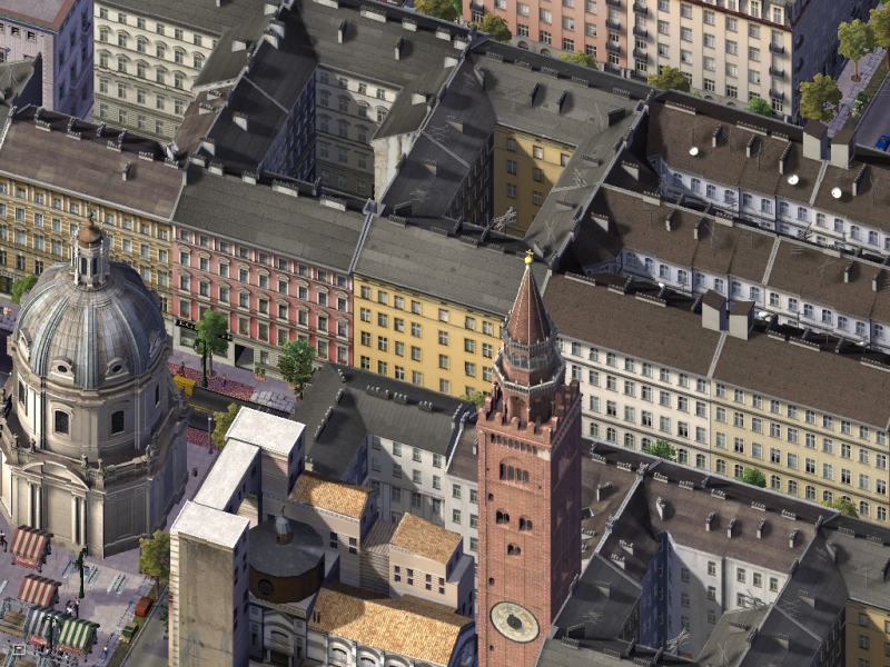


hiigarar- Ambassador At Large
- Posts : 1295
Age : 33
» AIN Fact Book Collection Part 3 (International Transport)
» AIN Fact Book Collection Part 5 (Education)
» AIN Fact Book Collection Part 6 (Demographics)
» AIN Fact Book Collection Part 9 (Total)
» AIN Fact Book Collection Part 2 (City Facts)
» AIN Fact Book Collection Part 5 (Education)
» AIN Fact Book Collection Part 6 (Demographics)
» AIN Fact Book Collection Part 9 (Total)
» AIN Fact Book Collection Part 2 (City Facts)
Page 1 of 1
Permissions in this forum:
You cannot reply to topics in this forum|
|
|